Impact
6-12 mo
End-to-end build cycle
How BS-Map Solves It
Plug-and-play SDK skips zero-to-one build
Robot SDK, cloud APIs, and app source code form a standard integration package so teams focus on differentiation.
60% shorter R&D cycle
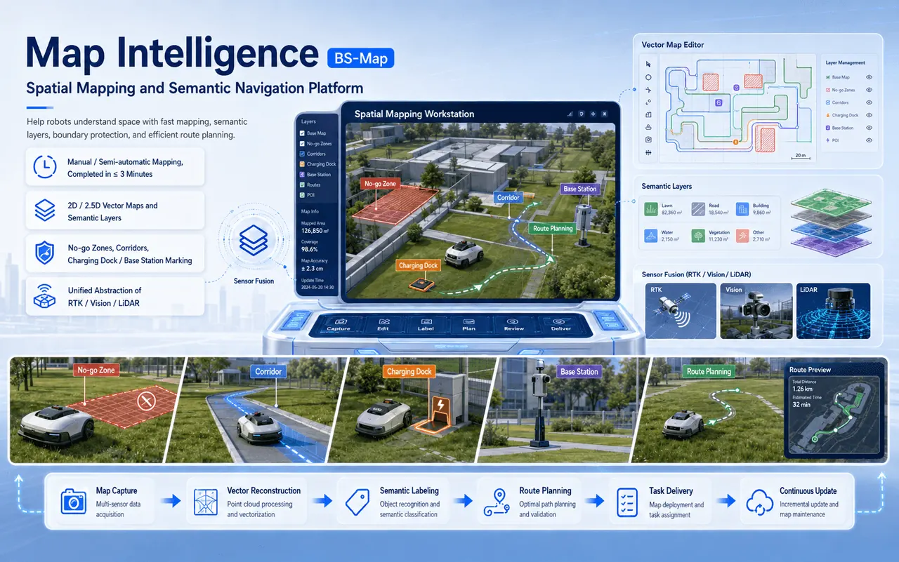
BS-Map is BigSight CloudTrace's three-end integrated spatial intelligence platform spanning device, cloud, and APP. From mapping, editing, and planning to execution — SDK plug-and-play empowers hardware makers to focus on innovation while delivering industry-leading map capabilities.
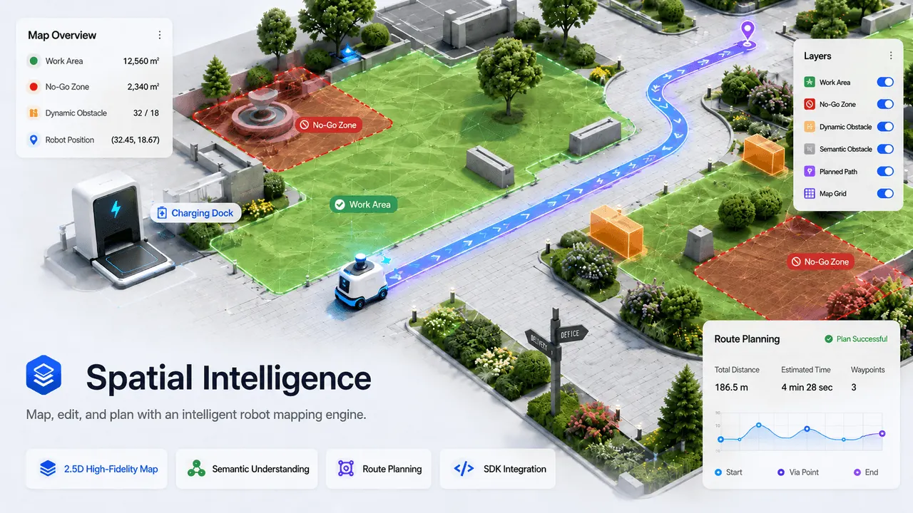
BS-Map delivers end-to-end software capabilities from mapping and editing to planning and execution, so hardware makers don't need a large mapping algorithm team.
Powered by 3D LiDAR SLAM and vectorized map engines with high-FPS rendering, it delivers a map interaction experience rivaling smart car cockpits.
Impact
6-12 mo
End-to-end build cycle
How BS-Map Solves It
Robot SDK, cloud APIs, and app source code form a standard integration package so teams focus on differentiation.
End-to-end in-house development from SLAM to app mapping takes 6-12 months, missing the optimal launch window
SLAM experts don't know app UX; frontend developers don't know robot communication. Building the team is a challenge in itself
Raster maps look rough; users can't read yard structures. Zone editing is useless, dragging down app ratings
Obstacles marked manually; can't adapt to environmental changes. "Smart" remains just a slogan
Device, cloud, and app integration consumes 40% of development time
Millions invested for "just a viewable map" that fails to create product premium
Standard SDK. One Integration, Pro-Grade Mapping Ready
From mapping speed to interaction experience, from AI understanding to SDK delivery — every advantage amplifies product competitiveness.
Auto boundary mapping + manual remote control dual modes. Robot scans autonomously, completing yard digitization in 3 minutes with AI-powered quality checks.
Vector-based engine, not rough raster grids. Isometric projection, shadow offset, and grass textures deliver 30fps smooth scaling — users will say "wow" at first sight.
Tap to add vertices, drag to reshape, remote walking to auto-generate precise zones. 50-step undo/redo with real-time conflict detection — as easy as photo editing.
YOLOv8 + MobileNet edge inference auto-identifies trees, flower beds, and obstacles. Adapts to environmental changes and grows smarter over time, with cloud-based algorithm updates.
Multi-strategy full-coverage and point-to-point path planning with animated previews. Real-time display of completed, in-progress, and pending areas — the map itself is a progress bar.
Python/C++ robot SDK + RESTful API + Flutter app source code. Integrate with a few lines of code. Modular purchase — enable only what you need.
From mapping speed to interaction experience, from AI understanding to SDK delivery — every advantage amplifies product competitiveness.
Auto boundary mapping + manual remote control dual modes. Robot scans autonomously, completing yard digitization in 3 minutes with AI-powered quality checks.
Vector-based engine, not rough raster grids. Isometric projection, shadow offset, and grass textures deliver 30fps smooth scaling — users will say "wow" at first sight.
Tap to add vertices, drag to reshape, remote walking to auto-generate precise zones. 50-step undo/redo with real-time conflict detection — as easy as photo editing.
YOLOv8 + MobileNet edge inference auto-identifies trees, flower beds, and obstacles. Adapts to environmental changes and grows smarter over time, with cloud-based algorithm updates.
Multi-strategy full-coverage and point-to-point path planning with animated previews. Real-time display of completed, in-progress, and pending areas — the map itself is a progress bar.
Python/C++ robot SDK + RESTful API + Flutter app source code. Integrate with a few lines of code. Modular purchase — enable only what you need.
Modular Design. Mix and Match. Build Your Mapping Capability Like Lego Blocks.
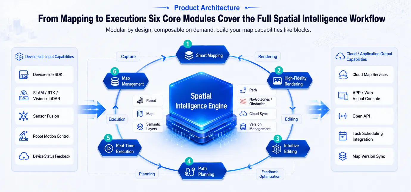
Auto boundary + manual remote dual modes, AI quality checks, one-click vectorization
2D/2.5D vector rendering, semantic layers, 30fps smooth interaction
Gesture-based zoning, obstacle marking, no-go zones — WYSIWYG
Full-coverage / point-to-point multi-strategy, AI auto-optimization, visual preview
Real-time robot tracking, remote start/stop control, clear progress visibility
Multi-map switching, pre-built map search, cloud sync, version control
Modular Design. Mix and Match. Build Your Mapping Capability Like Lego Blocks.
Auto boundary + manual remote dual modes, AI quality checks, one-click vectorization
Seven functional modules covering the full closed loop from mapping, rendering, editing, AI understanding, and execution management.
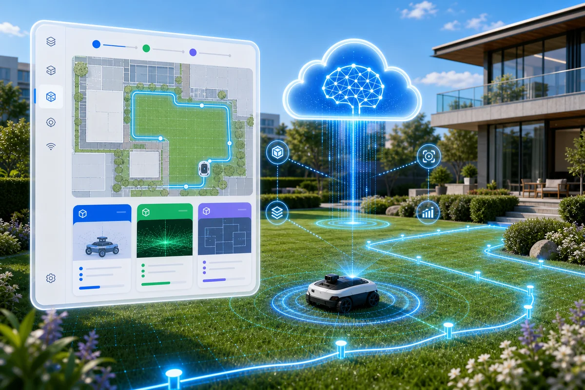
Say goodbye to maze-like mapping. One boundary walk, fully automatic. Supports both auto-mapping (robot walks boundary autonomously) and manual mapping (APP Bluetooth remote control). Real-time visualization: scanned areas in green, current boundary in flowing blue, unscanned areas clearly visible.
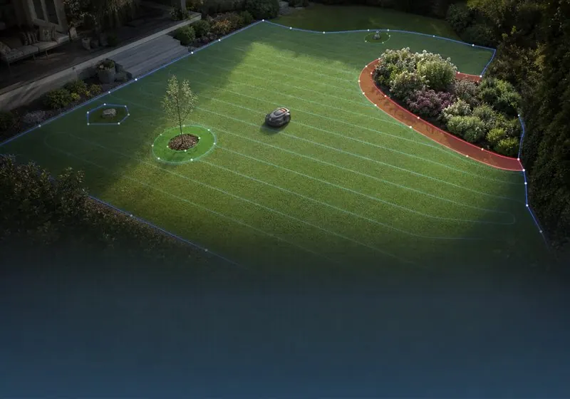
Precise yard zone management, intelligent obstacle avoidance, complete coverage
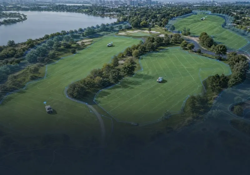
Large-area pre-built maps for golf courses/parks, multi-robot dispatch
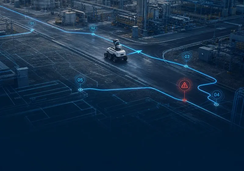
Set patrol routes, checkpoint verification, precise anomaly marking
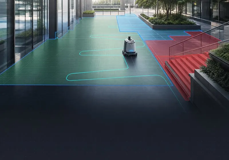
Indoor/outdoor zone cleaning strategies, auto no-go zone recognition
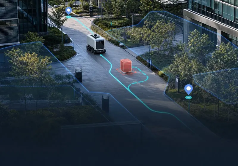
Point-to-point navigation, corridor priority, dynamic re-planning
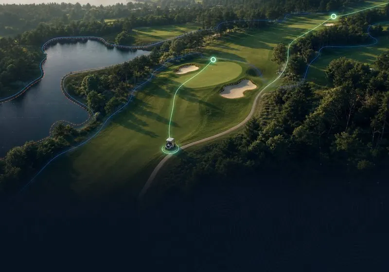
Course pre-built map navigation, optimal hole-to-hole paths, real-time location sharing
BS-Map isn't designed for one type of robot — it's designed for every intelligent device that needs to move through space. Mow today, inspect tomorrow. Scale scenarios without changing architecture.
"Maps aren't a cost — they're a competitive edge. BS-Map makes that edge plug-and-play."
Some interface images above are system mockups, not actual screenshots. The actual system UI is as demonstrated by our sales team.